

Smart Chart AIS app for iPhone and iPad
Developer: Team Augmented Reality, Inc.
First release : 21 Jun 2014
App size: 18.24 Mb
Get the Picture with Integrated Charts, Weather, Augmented Reality, Cruising Guidance, AIS, Social Networking, and more... All on your smartphone for FREE!
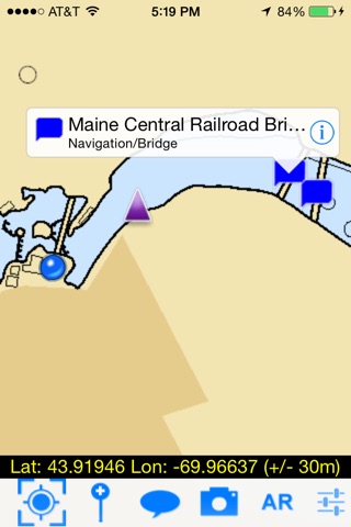
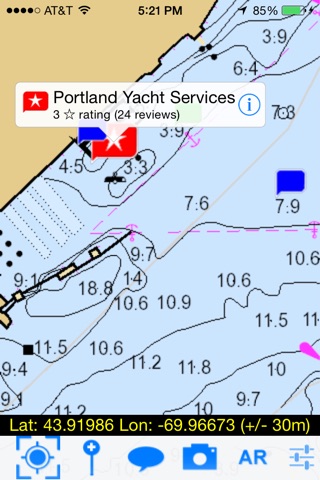
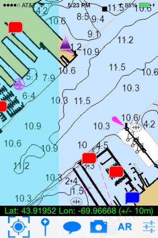
CHARTS
- NOAA electronic charts
- Satellite imagery, topographic maps, roads
- NEXRAD and similar live weather
- Overlays showing important warning zones (such as weather, security, etc.)
AIS-i
- Lets you see AIS-i and B traffic without needing an expensive receiver
- Gives you unparalleled emergency safety thanks to Instant Position Reporting
- Provides clear identification of other vessels: type, size, speed, heading, etc.
- Operates over cellular networks
ACTIVE CAPTAIN CRUISING INFO
(constantly updated, user-generated content)
- Navigation information, pilotage, insiders typs, etc.
- Marinas (fuel types, prices, etc.)
- Dockage (prices, requirements, etc.)
- Pump-out services, ramps, etc.
- Recommended anchorages with details
- Reviews
- Contact info
AUGMENTED REALITY VIEWS
Your phone or tablet gives you an invaluable view into whats obscured by fog or darkness. Youll see buoys, channels, hazards, and more, so you can navigate safely to your destination regardless of visibility.
SOCIAL NETWORKING ON THE WATER
- Chat boat-to-boat with friends and fellow boaters
- Join discussions with like-minded boaters in chat rooms
- Share pictures
- Share waypoints, zones, and other locations
- Quickly find your friends out on the water and in harbors and anchorages
Smart Chart AISs development has been supported by the US Despartment of Homeland Security under the Small Business Innovation and Research Program, Contract #D12PC00364.
© Copyright Technology Systems Inc 2010-2014 All rights reserved